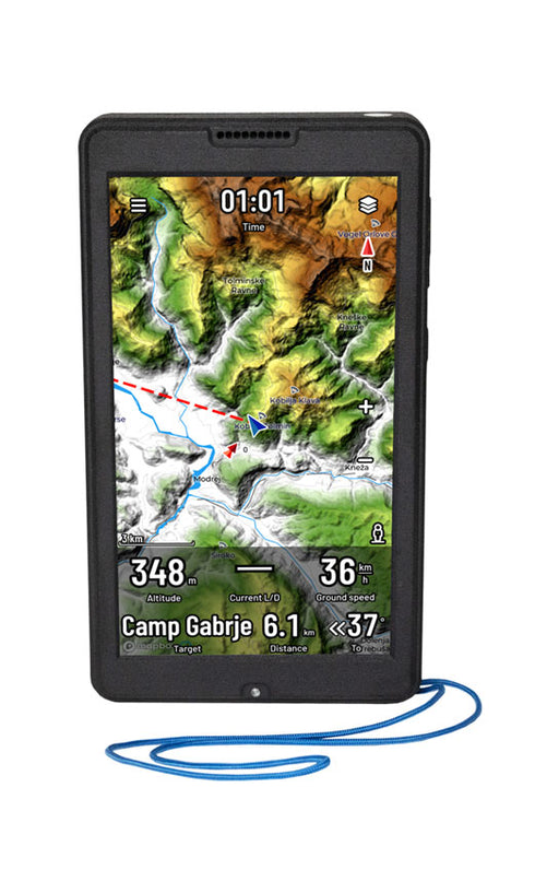
Oudie N
Oudie N – the game changer
Every pilot knows how important it is to have the right flight plan and up-to-date weather information. Oudie N brings live data and seamless integration with SeeYou to your cockpit, so you can focus on what’s important to keep you flying for longer and further.
Features and Benefits
- Crystal clear, sunlight readable display.
- Exceptional battery life even at full brightness.
- Easy to use SeeYou Navigator software.
- Backup vario.
- Wifi, Bluetooth and 4G/LTE connectivity.
- Optimize cross-country and competition tasks to perfection.
- Scan QR codes instead of entering data manually.
- No internet connection? No problem with Offline maps.
- Charge your phone after landing from Oudie N.
- Free 1-year usage of SeeYou for seamless integration
One software, three platforms
Android & iOS Phone
Are you on a budget or do you just want to try the Navigator software before committing to Oudie N?
Install SeeYou Navigator on your iPhone or Android smartphone. It is the same software that powers the Oudie N.
Oudie N Gliding
If you fly for leisure without the stress of trying to achieve the best results in competition or flying records, Oudie N is for you.
It is a reliable portable navigation device with a bright screen, a large battery, and highly accurate sensors.
Oudie N IGC
Want to win competitions, achieve badges, set personal, national and world records?
You can do that with the same reliable platform that adds electronics with the highest possible IGC Approval for gliders and powered sailplanes.
Compare platforms
Android & iOS Phone
✅ Navigate
✅ Avoid airspace
✅ Record a flight
✅ Live weather
✅ Upload to OLC
✅ Lots more >
Oudie N Gliding
Everything from Phone plus
✅ Backup vario
✅ Huge battery
✅ Sunlight readable LCD
✅ High-precision sensors
✅ One year use of SeeYou included
Oudie N IGC
Everything from Oudie N Gliding plus
✅ IGC Approval for World records
✅ Approval for Category 1 competitions
✅ Engine noise recording for self-launching sailplanes
✅ ENL for sustainer engines
✅ ENL for electric engines
Software development for Oudie N is continuous
Oudie N is powerful new hardware running new user-friendly SeeYou Navigator software. It will be regularly upgraded to include new software features. These upgrades will be free throughout the life of your Oudie N and can be easily installed over Wifi. Please check the Oudie comparison table for all the features currently available and a list of features that will become available for the Oudie N in the future.
Oudie N Specification
| HARDWARE | |
| Screen | 5.5-inch screen size |
| 1920×1080 Full HD resolution | |
| 1000 nits brightness | |
| Portrait and Landscape orientation | |
| Multi-touch (pinch&zoom) | |
| Size | 150 x 86 x 24 mm (5.9 x 3.3 x 0.95 inch) |
| Weight | 430 g |
| Battery | 16000 mAh |
| 15+ hours autonomy at full brightness | |
| 20+ hours on a typical day with auto-brightness | |
| 64+ hours of continuous flight recording with screen powered off | |
| 6 hours charge time from empty to full | |
| Sensors | High-precision pressure sensor (<10 cm) |
| High-accuracy GPS, Galileo & GLONASS GPS receiver | |
| Gyro-assisted instant Vario | |
| Connectivity | USB Type-C |
| USB OTG | |
| Wifi, Bluetooth LE, 4G/LTE | |
| Wifi and Bluetooth Internet tethering | |
| Fanet+ (optional) | |
| Memory | 4 GB RAM |
| 64 GB Flash | |
| Operating system | Android 9 |
| SOFTWARE | |
| Navigation app | SeeYou Navigator |
| SeeYou Navigator upgrades included for the lifetime of the device | |
| Maps | Worldwide, high resolution |
| Street-level detail | |
| Terrain color scheme (SeeYou default) | |
| Outdoor scheme | |
| Light scheme | |
| Satellite maps (requires internet connection) | |
| Download maps for offline use in advance to reduce download | |
| Task | XC tasks |
| Racing tasks | |
| Assigned areas | |
| Elapsed time | |
| Free flight | |
| Choose a task from Soaring Spot | |
| Scan a task QR Code | |
| Connectivity | External devices by Bluetooth Low Energy |
| Flarm Bluetooth dongle | |
| LXNAV Bluetooth dongle | |
| Condor Bluetooth dongle | |
| Features | Record flight track (IGC file) |
| Airspace warning | |
| Thermal assistant | |
| Final glide assistant | |
| Cross-country optimization | |
| Logbook | |
| Airport database | |
| Airspace database | |
| Load custom airspace file | |
| Fully configurable map screen | |
| Automatic airspace updates | |
| Pinch & zoom | |
| Online features | Rain Radar layer |
| Open Glider Network layer (OGN) | |
| KK7 skyways and thermals | |
| TopMeteo forecast layers | |
| SkySight forecast layers | |
| TopMeteo live Satellite picture | |
| SkySight live Satellite picture | |
| Upload to Online contests | |
| Seamless integration with SeeYou Cloud | |
| Seamless integration with Soaring Spot | |
| Automatic airspace updates | |
| Automatic database updates |


